Intro to GIS for Public Health
Epidemiology
The study of the distribution of Disease and Disease Related States
By Person
By Place
By Time
By Person
Who is likely to get the disease? What are the risk factors
Case Control Studies
Cohort Studies
Randomized Control Trials
Quasi-Experimental Designs
By Time
How is the disease changing over time?
Time Series Analysis
Cohort Studies
Repeated Cross Sectional Studies
By Place
Ecological Studies
Case Control Studies
Difference in Difference Designs
Who? Where? When?
GIS Provides the “where” in the traditional “who, where, when triad” in epidemiology
It can also be clubbed with the when - to provide “Spatio-Temporal” Insights.
GIS
Geographical Information Systems
Geospatial Information Systems
Spatial Data Science
Is Mapping in Public Health New?
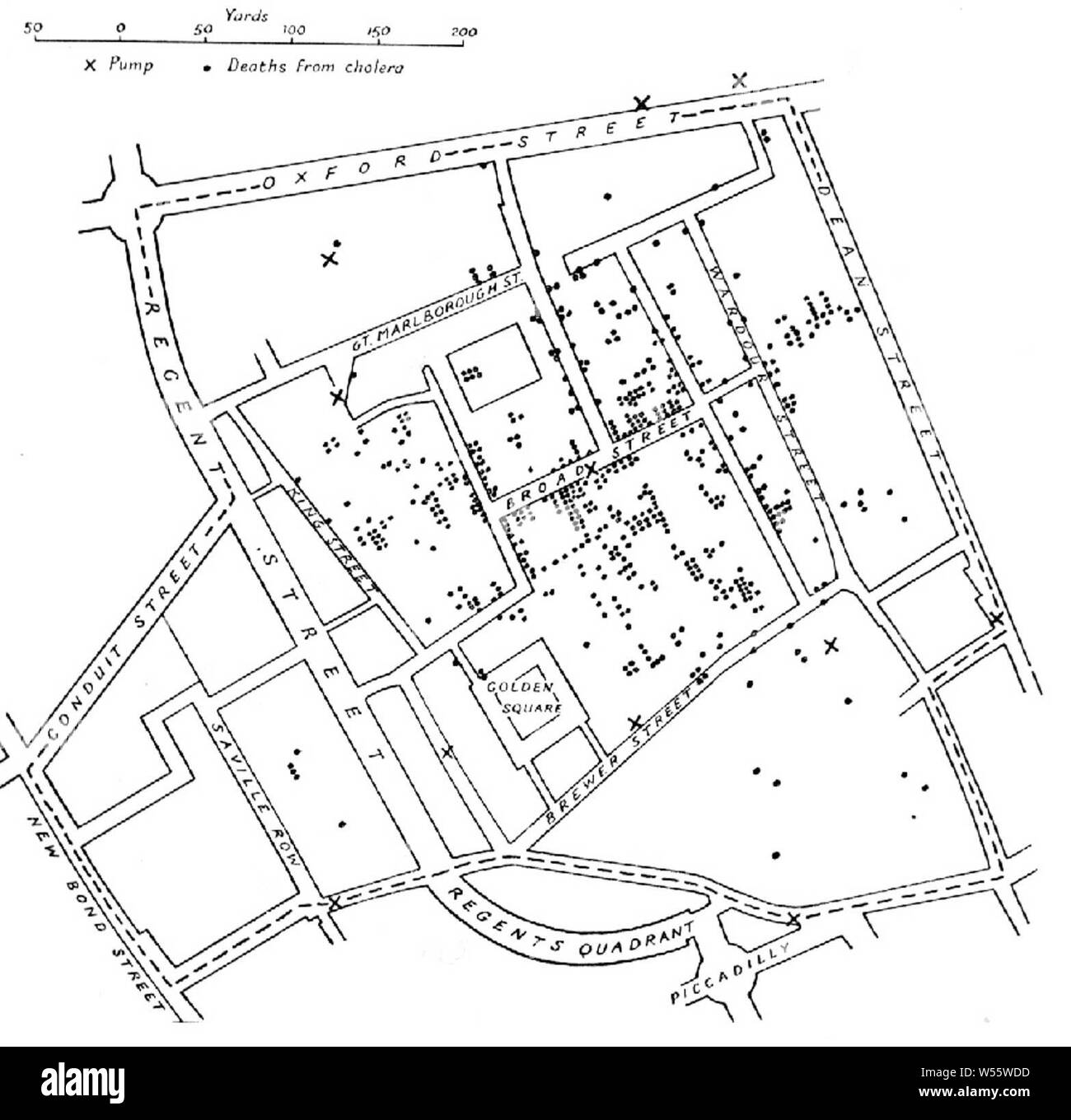
Advantages of Hand- Drawn Paper Maps?
- Local Knowledge?
“The Map is not the territory” - In-Depth knowledge of intricacies that may not be captured on the map.
Accessibility - Do not need special training or tools
“Fail Safe” - Do not depend on technology / power requirements etc
Disadvantages of Hand Drawn Paper Maps
Not to scale?
Precision in distance , etc
Difficult to stack maps on top of each other
Static and Difficult to Update
Limited by size and scale
So what then is GIS anyway? Is it just a digital map?
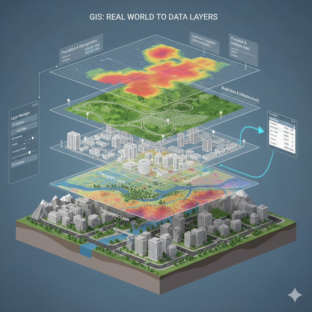
A GIS system has 2 main components
A geography or shape (eg - Points, Polygons, Boundaries, Rasters) - WHERE
A table storing information - WHAT
GIS vs Static Maps
Creating Maps is one of the many possibilities of GIS
GIS is not about simply displaying static information but allowing the users to ask questions of the data
What is the shortest distance from Point A to Point B
What is an ideal catchment area for my services
How is the distribution of air-pollution related to the distribution of COPD
Tools used for GIS
A wide combination of software solutions can be used for GIS related work.
ArcGIS - Commercial , Proprietary - Licences are approximately (Prices could vary from USD100 to USD3800 per Year depending on licence types)
QGIS - Free and Open Source.
Other Useful Programming Languages handy for GIS
Python
R
SQL / PostGIS
Types of Data in GIS
Vector Data
Points
Lines
Polygons
Raster Data
A type of Digital photograph that represents Continuous Data where values change gradually over space
Population
Elevation
Land Use / Land Cover
Temperature
Real World to GIS Layers